
Giethoorn, the Netherlands: Beyond the Picture-Perfect Village
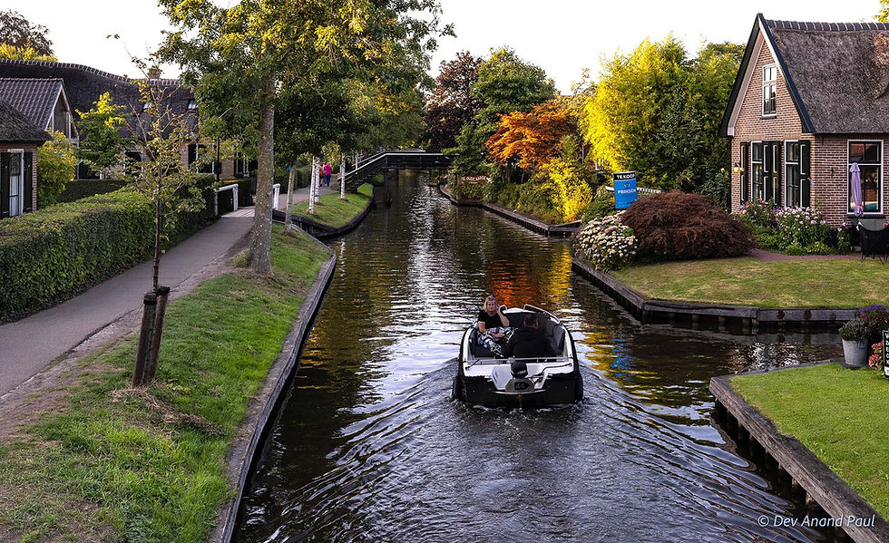
Giethoorn is a small village in the Netherlands located roughly 120 kilometres northeast of Amsterdam. Before I visited it, my expectations of the place were shaped by photographs, which were invariably always the same elements: narrow canals cutting past houses, small boats gliding through calm water, wooden footbridges connecting the banks, and green lawns lining the canals. They left an impression that the waterways were still the core of everyday life. Drawn by its beauty, I booked an overnight stay for a leisurely experience, rather than joining the crowd on a standard day trip from Amsterdam.

We arrived at Giethoorn around noon to find the main thoroughfares swarming with visitors, and the narrow canals were choked with boats so close that traffic moved bumper to bumper. The wooden bridges were cramped with people standing shoulder to shoulder, snapping pictures, while boats converged from every direction. The waterways were a loud, chaotic maze of movement. I watched the gridlock awhile, wondering if I had walked straight into a tourist trap.
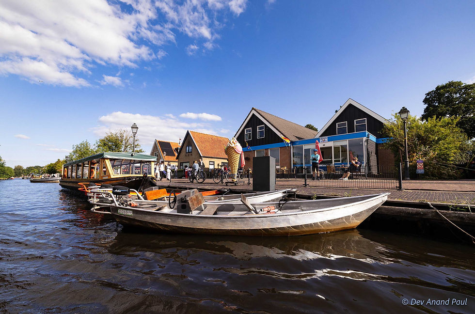

To escape the crowds, we hopped on a 1-hour canal cruise, which also gave us the advantage of seeing the village from the water level. As we moved along the canals, the actual character of the place unveiled. Small houses lined the narrow strips of land, their painted shutters, manicured gardens, and wooden bridges draped in flower boxes a sight to behold. Mallards and swans drifted past our hull, entirely indifferent to the traffic.


As we moved through the canals, the heavy roofing on the houses caught my eye—thick layers of tightly packed reed instead of the standard baked tiles used across Europe. The boatman, a witty young guy, explained that the reed grows naturally in the marshlands surrounding this region. Two centuries ago, when the local population was impoverished, it was the cheapest, most practical material available. Today, maintaining a traditional reed roof is a luxury, far more expensive than modern alternatives; yet local homeowners maintain them, preserving the physical history of the buildings.

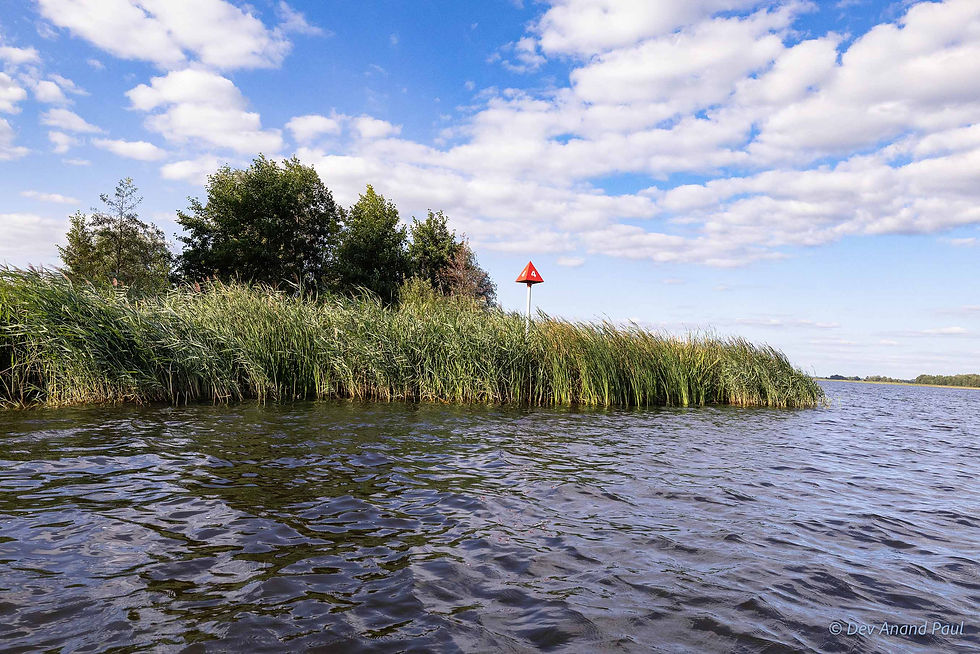
The name Giethoorn is tied directly to its landscape, with two fascinating origin theories. Historical records from 1230 note the settlement as ‘Gethorne’. According to local legend, the very first settlers (refugees from the Mediterranean) discovered hundreds of wild goat horns buried deep in the mud after a massive medieval flood years prior and named the site Geytenhoren (meaning ‘goat horns’). Another theory connects the name to the dark peat soil—git referring to the pitch-black colour of the earth and hoorn meaning a corner or projecting piece of land.

As our boat pushed deeper into the network, the layout made more sense. Although the maze of canals looks intentional, it was actually formed by a combination of manual labour and natural disasters. Centuries back, this region was blanketed in thick layers of peat—a dense, spongy material left behind by thousands of years of decaying marsh vegetation. The waterlogged ground was useless for traditional farming. To survive, the early settlers dug deep drainage ditches to draw the water away. Later, they realized the dried peat could be cut out of the ground and used as fuel.

This systematic extraction completely reshaped the landscape. The deep trenches filled with water, leaving behind only narrow ribbons of earth. The locals called these remaining strips of land ribben or legakkers, which were used to dry the wet peat in the sun. Then nature intervened. In the 1775/76 winter, severe storms battered the area and washed away the fragile earthen barriers that separated the dug-out pits. And in November 1776, a massive flood completely submerged the neighbouring village of Beulake. The land barriers between the peat pits broke down permanently, turning the series of pits into the expansive lakes that now form the modern Wieden landscape surrounding Giethoorn.


The hand-dug, storm-widened canals quickly became functional highways. Villagers relied on large, sturdy vessels called bok for heavy agricultural labour, especially to transport cattle and manure; midsize boats known as vlot for hay and reeds; and smaller boats, the traditional punts, for everyday deliveries. For generations, bakers, milkmen, greengrocers, postmen all used these punts to deliver goods directly to households. These flat-bottomed wooden vessels were designed specifically to manoeuvre through the shallow, tight corners of the village canals.

Watching the waterways that afternoon, I couldn’t connect that history to the present; the canals were completely busy carrying sightseers, not farmers or utility workers.

The transformation of Giethoorn from an isolated farming outpost to a global destination happened in stages. In 1880, the Dutch painter Willem Bastiaan Tholen visited the village and captured the unusual landscape on canvas. His artwork exhibition in Amsterdam and The Hague introduced the remote community to a wider public. Soon after, a Dutch cycling organization, ANWB, began routing excursions through the area, and in 1905, it featured the village in its magazine, De Kampioen. By the 1920s, holiday travellers were regularly renting punts to tour the village. The real turning point, however, came in 1958, when filmmaker Bert Haanstra shot his comedy movie Fanfare on location here, introducing the village to international audiences.

Although commercial growth changed the village completely, it also provided the means for its survival. Without the revenue from global travellers, Giethoorn’s fragile canals and historical footpaths would likely have been altered or paved over to accommodate modern vehicles. Instead, the economic value of tourism drove a dedicated preservation effort. In 1985, the government designated Giethoorn a protected townscape, establishing rigid architectural codes to safeguard its physical layout.

By the time our boat cruise ended, the afternoon crowds had started moving towards the tour buses to catch their evening transport back to Amsterdam. The engine noise faded, the footbridges cleared, and a heavy silence settled over the water.
As twilight fell, my wife and I decided to take a long walk along the footpaths. Watching warm lights turning on inside the thatched cottages was a beautiful experience. With the crowds gone, the practical layout of the village design became clear. The homes, lawns, and footpaths sat seamlessly on the narrow ribbons of earth, following the exact geometry of the ancient peat canals.

The Giethoorn landscape brought back a memory of a completely different water-locked landscape: Bhimruli, a village in the Jhalokati district of Bangladesh’s Barisal region.

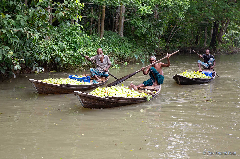
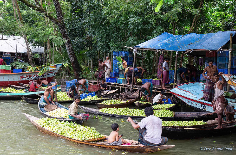
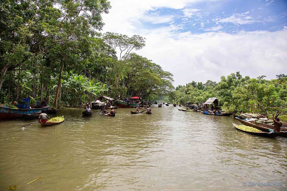
I visited the place during the peak of guava harvest, when the orchards are flooded and one has to navigate the place in a small wooden boat. The canals here are active lifelines. Small boats dart into the orchards, load the fruit upto the gunwales, and paddle out to a crowded floating market, where buyers and sellers trade entirely from deck to deck. No tourists, no souvenir shops, no staged displays—just a raw space brought alive with energy from daily survival.
The images of these two locations highlight the parallel worlds that existed across different times. Bhimruli is a living mirror of what Giethoorn used to be a long time ago—a place where life is defined by hard manual labour and water a strict necessity for daily survival. Modern Giethoorn offers a glimpse into the final stage of that evolution, showing what happens when a landscape born from grit and hardship totally transforms into a pristine, curated spectacle.

Have you ever visited a famous destination only to find it overrun by crowds? Would you prefer the curated charm of a place like Giethoorn, or the raw, bustling energy of a working market like Bhimruli? Let me know in the comments below—I’d love to hear your thoughts on finding authenticity while travelling.
Related posts
The Silk Road Explained: History, Trade Routes, and Cities of Uzbekistan
Registan Square, Samarkand: Understanding the Evolution of Islamic Architecture in Central Asia
Rishton Pottery: Uzbekistan's Ancient Blue Ceramics Along the Silk Road
Inside a Margilan Silk Workshop: How Traditional Ikat Silk Textile Is Made in Uzbekistan
Khiva, Uzbekistan: Itchan Kala, Silk Road Trade, and the City’s Hidden History
Bibi-Khanym Mosque, Samarkand: One of Islamic World’s Largest Mosques
Chilpik Dakhma, in Uzbekistan: Zoroastrian Towers of Silence and Parsi Migration to India
Tashkent Metro Stations: A Glimpse into Their Unique Underground Architecture
Aydarkul Lake, Uzbekistan: A Desert Lake Born from Soviet Irrigation
Samarkand Paper: A Visit to Konigil Meros Paper Mill in Uzbekistan
The Story of Indian Coins: 2600 Years of Wealth, Power, Trade, and Culture
Bhutan Postage Stamps: How a Small Kingdom Revolutionized Global Philately
The Battle of Colachel: How a South Indian Kingdom Defeated the Dutch
My Son Sanctuary: The Cham Temples of Vietnam and Their Indian Connection
Gandikota: The Grand Canyon of India


Comments